
Grade University
Centre.
- Preautions to be taken by the students before enrolling in Programmes offered under Open & Distance Learning (ODL) and or Online Learning (OL) mode
- Ph.D. Score Card Link
- Ph.D. Entrance Exam.2024 : Sample Mock Test Link
- Ph.D. Entrance Exam. Centres Location - (Shriram group of college, gwalior, National Expressway opp Narrow Gauge Railway station Gwalior-476444)
- Ph.D. Entrance Exam. Centres Location - (Bhartiya vidya mandir Yamuna nagar, Gwalior)
- Ph.D. Entrance Exam. Centres Location - (iON Digital Zone iDZ Chitoura Road, Bhartiya Vidya Mandir Shiksha Samiti Gram Rai Chitoura Road, Morar, Gwalior 474006)
- Admit Card Live for all Candidates Jiwaji University Ph.D. Entrance Test 31st March 2024
- Adhisuchana:- Cancellation of Old Advertisement
- Advertisements Director of Physical Education & Assistant Director, Physical Education
- Empanelment of Candidates For Guest Faculties (Session 2024-25)
- Advertisement Librarian and Assistant Librarian
- Librarian and Assistant Librarian Application Form
- Office Order : - Anti Ragging Rules
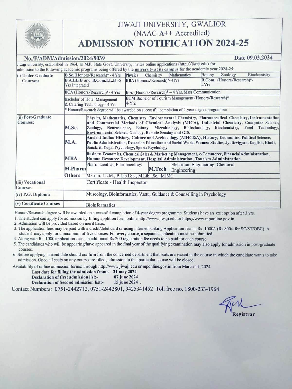
- Ph.D. ADMISSION NOTICE, 2024
- View All


NAAC Accredited
A++ Grade
University
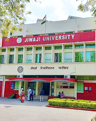
Jiwaji University Gwalior came into existence on May 23, 1964, through M.P. Govt. Ordinance no. 15 of 1963. Late Dr. Sarvapalli Radhakrishnan, the then President of India, laid the foundation stone on 11th December 1964 at a sprawling campus of over 225 acres of land at Naulakha Parade ground.
QS Rank: 86-90
UNI Rank: 114
SIR Rank: 85
Education World Rank: 77


FACILITIES AT JIWAJI UNIVERSITY
International Convention Centre
Distance Education
Central Library
Central Instrument Facility
Anti Rag. / DSW / Proc. Board
Technology Is Transforming Every Industry Sector


VC Desk
Dear students, faculties and all stakeholders of the esteemed Jiwaji University,
It brings me immense pleasure to address you all today out of all days. Because today marks the beginning of a new journey, a new dawn, a new chance to march towards our vision and mission with renewed strength and eagerness. The vision to continue to establish Jiwaji University as a frontier and leading University for academic excellence and innovation.The mission to be a flagship of research development that meets industry and national needs, all the while keeping students and excellence at the core.
Sincerely
Avinash Tiwari
Vice Chancellor, Jiwaji University

Hon. Governor of MP
He expressed his heartfelt happiness to Jiwaji University for getting NAAC GRADE A++ Hearty congratulations to the management, faculty, workforce as well as to our students. He also added that getting A++ in NAAC is a great achievement for our university since it adds more quality and boost higher education system in our state.
Sincerely
Mangubhai Patel
Hon’ble Governor of Madhya Pradesh
Our Awesome Pricing Plans
Basic Plan
- 24/7 system monitoring
- Security management
- Secure finance backup
- Remote support
Standard Plan
- 24/7 system monitoring
- Security management
- Secure finance backup
- Remote support
Extended Plan
- 24/7 system monitoring
- Security management
- Secure finance backup
- Remote support


VC Desk
Dear students, faculties and all stakeholders of the esteemed Jiwaji University,
It brings me immense pleasure to address you all today out of all days. Because today marks the beginning of a new journey, a new dawn, a new chance to march towards our vision and mission with renewed strength and eagerness. The vision to continue to establish Jiwaji University as a frontier and leading University for academic excellence and innovation.The mission to be a flagship of research development that meets industry and national needs, all the while keeping students and excellence at the core.
Sincerely
Avinash Tiwari
Vice Chancellor, Jiwaji University
Here’s what our customers have said.

Arnold Burner

Sachin Diwar

VP of Network
Our Latest Blog


